One of my favourite Youtube channels is About Here, created by Uytae Lee, who I had the pleasure of speaking with earlier this year. In a recent video on his channel, he compares cycling in Surrey to cycling in Saanich.
The state of cycling in Langley is very similar to Surrey, to get to most places you are often forced onto busy roads which feel unsafe.
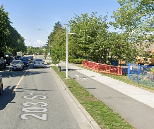
The response to this seems to be to try and make these routes safer, either in the form of protecting the cycle lane, or making the sidewalk into a Multi-use Path. Langley City has been very proactive in this approach, Glover Road now features (award winning) protected bike lanes, 203 St and some other streets have multi-use paths, and Douglas Crescent has seen a travel lane removed, replaced with a two way bike path.
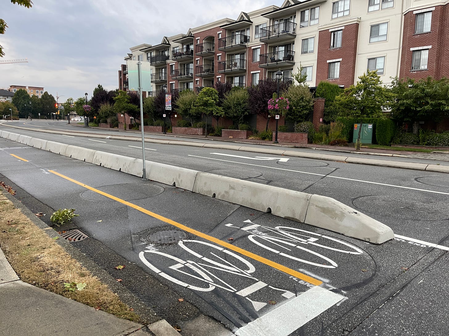
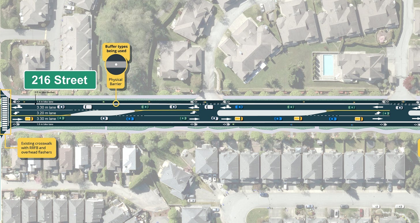
In the Township, strides are also being made. 80 Ave is being redesigned and widened between 204 Street and 212 Street and will feature protected bike lanes as shown in the specification sheet, similar to what is near the 216 St highway overpass (shown on the right).
While we are generally not keen on road widening, it is encouraging to at least see protected cycling infrastructure included as standard in this project.
Similar treatments are apparently planned for sections of 208 Street in Willoughby, though it remains to be seen in the areas currently being widened.
216 Street in Walnut Grove is also encouraging, undergoing a complete retro-fit which incorporates protected bike lanes, the first of it’s kind in the Township of Langley.
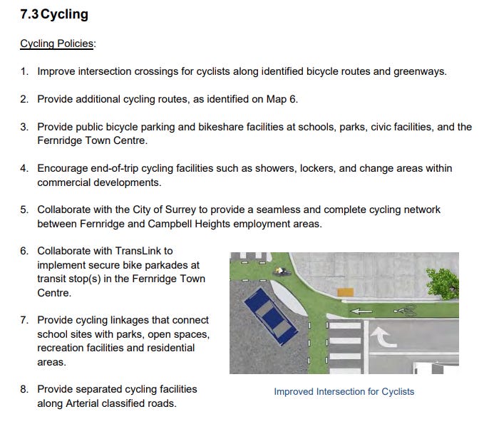
And finally the Brookswood Neighbourhood Plans even featured a Dutch-style cycling intersection as a suggested intersection design.
These are all very positive developments, and I want to take a minute here to acknowledge this clear effort from both councils and staff to improve cycling and road safety.
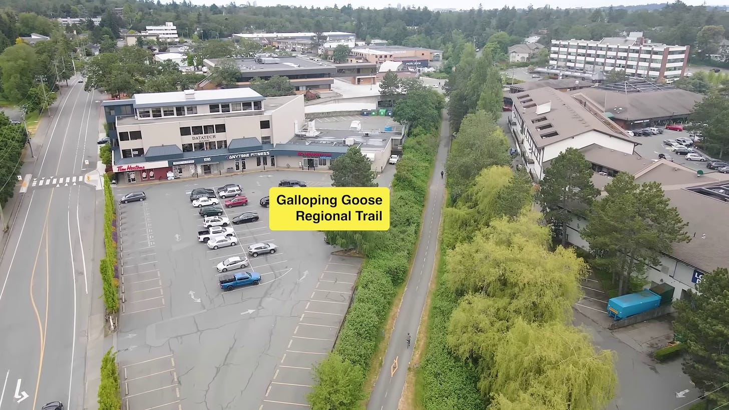
However, while these intentions are good, and do improve safety, it can still feel intimidating to be at road level right next to large and noisy vehicles, even if there is a block of concrete between you and the traffic. In the About Here video, it shows how Saanich has a greenway that goes right through the centre of town, away from cars and traffic, known as the Galloping Goose Regional Trail.
There’s no doubt in my mind that a quiet and pleasant and functional greenway like this has likely done far more to spur on cycling than a handful of protected cycle lanes on busy roads. In the video, Uytae describes it as the “rolls-royce of bike paths”.
And these kinds of bike paths are surprisingly rare. Despite the Brookswood plan section above mentioning greenways, most cycling facilities are being planned along existing (and often busy) roads.
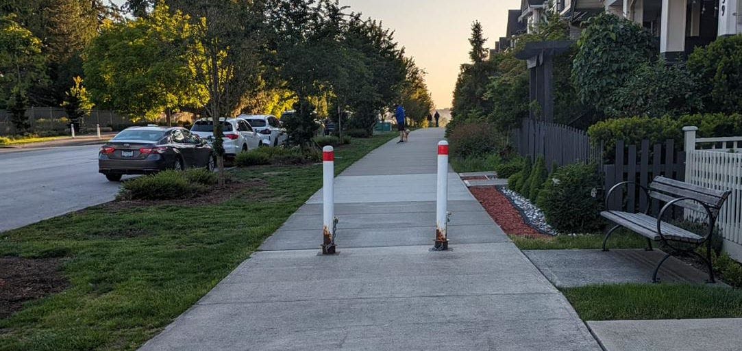
Yorkson in Willoughby focused on adding multi-use paths, however these can cause problems and slowdowns as they mix pedestrians and cyclists, are often paved in a “squiggle” shape to try and slow down cyclists, and frequently feature obstructive bollards too narrow for a cargo bike to squeeze through.
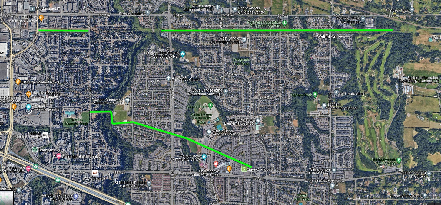
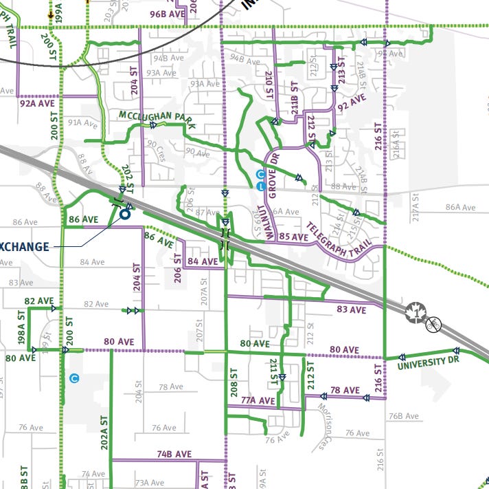
Walnut Grove has two greenways, the North Langley Greenway, which sits on top of the original Trans-mountain pipeline, and the Langley Lane Greenway, which sits below power transmission lines.
However both of these greenways have their shortcomings, with a housing development rather shortsightedly being allowed to block the Langley Lane Greenway in the west, and the greenway terminating before it reaches Fort Langley, which would have made it far more useful as a connector. The North Langley Greenway also features a difficult to traverse ravine in McClughan Park and has poor quality pavement in many areas.
It seems as though Greenways are often an afterthought, despite being one of the most desirable ways to cycle around town away from traffic and noise. Frustratingly, they are rarely even differentiated on maps, with both the Township of Langley’s and Translink’s cycling map color coding greenways the same as street routes and multi-use paths.
Unlike Langley City, in the Township there are still large rural areas that will in future become new neighbourhoods, so there’s no reason these places shouldn’t feature a good quality greenway network that co-exists alongside the road network, and right now we’re dropping the ball.
So, what could this look like?
In the UK after World War 2, there was an effort to build more places for people to live, and these became known as new towns. These new towns were planned from scratch, and many often featured complete-off grid cycling networks.
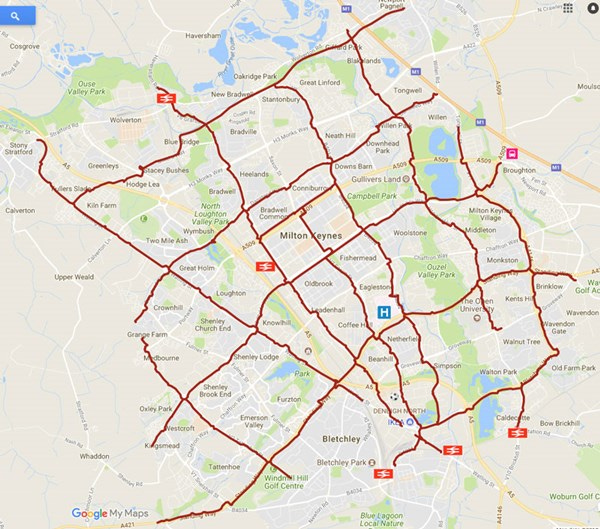
Milton Keynes, arguably the most “north-american style” city in the UK, with a road grid plan as opposed to a radial pattern, was one of these such new towns, designed in 1967. Along side the street grid however, was designed a network of redways, dedicated routes for cycling, which connect every corner of the city.
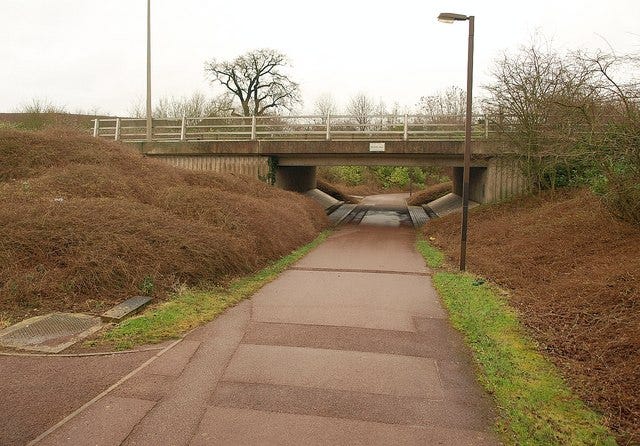
Many Redway routes pass under the main grid roads through purpose-built tunnels or underpasses. This allows cyclists and pedestrians to cross busy roads safely without interacting with traffic.
While Langley has made positive strides with protected bike lanes, adopting a more serious approach to a dedicated greenway network could help create a place where it is genuinely enjoyable, rather than simply tolerable, to cycle, leading to more residents to choosing bikes for their daily transportation needs. We also need to look at the gaps between neighbourhoods - it should be possible to safely get between any of the major neighbourhoods in Langley by bike on a dedicated safe route.
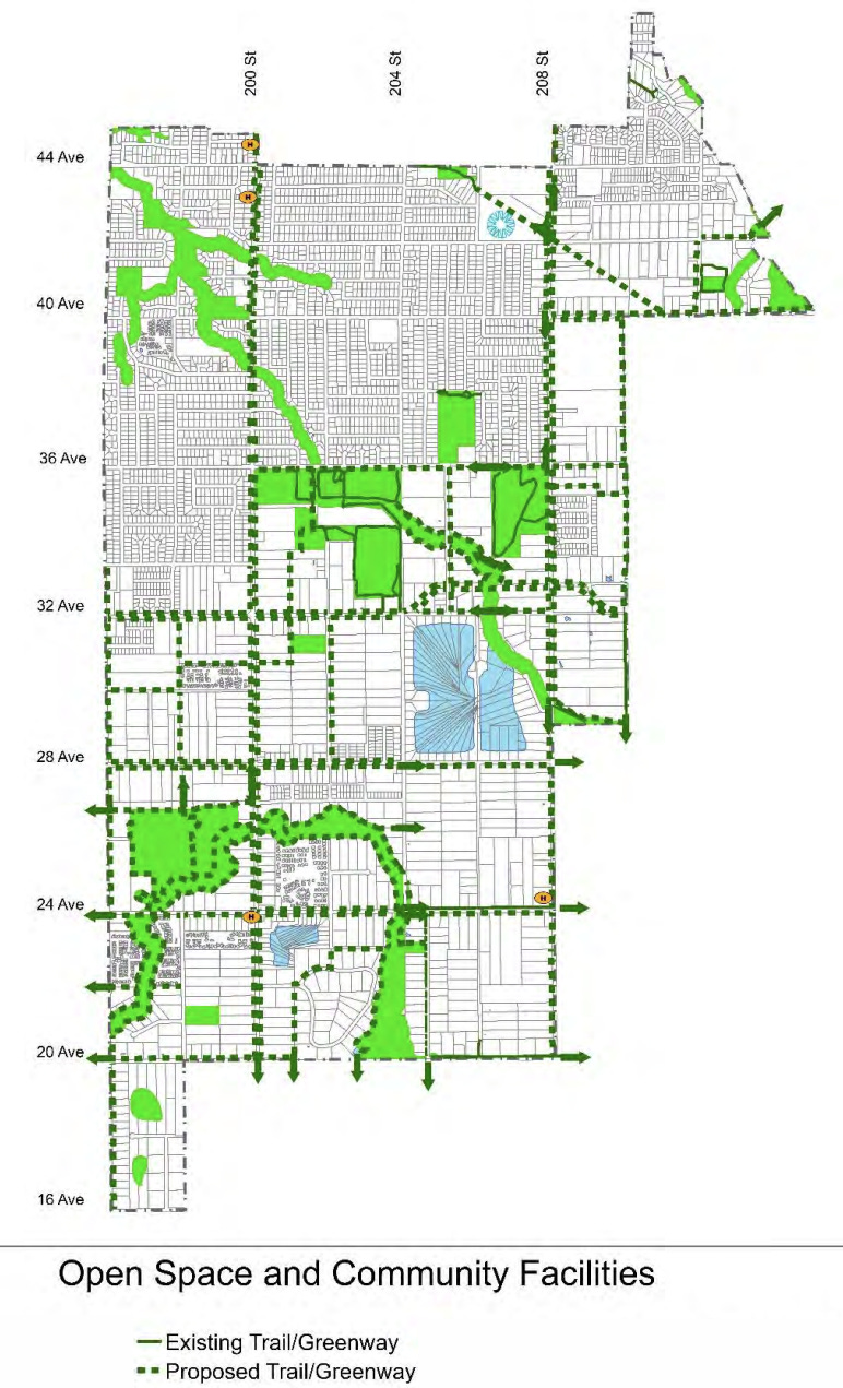
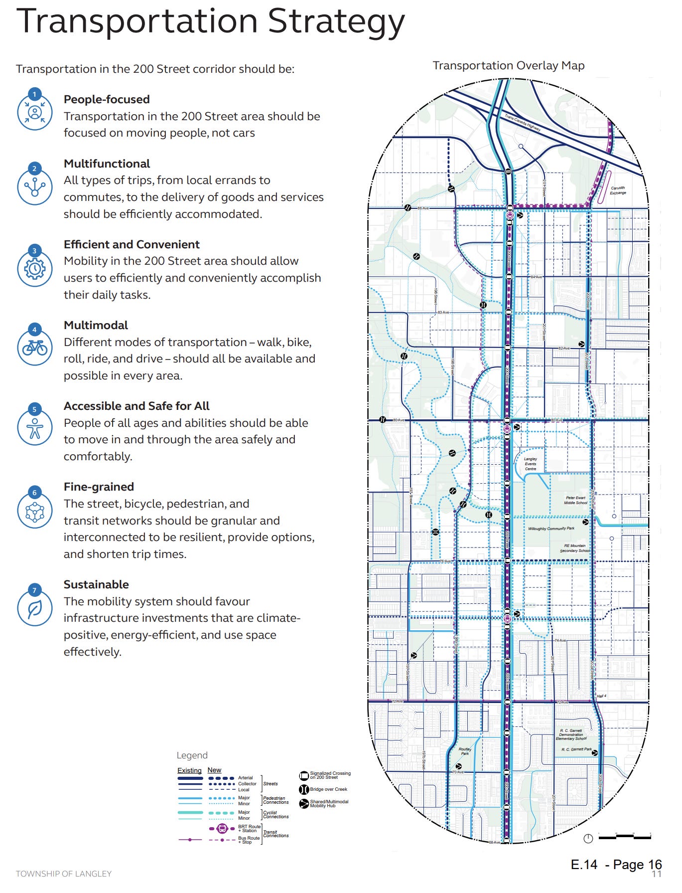
The 200 St 2040 plan might be a sign that we are heading in this direction, as it features an extensive pedestrian and cycling grid.
However, it remains to be seen just how these trails will interact with the road grid, or 200 St in particular, which acts as a huge obstacle for cyclists and pedestrians to cross. The plan document makes no calls for underpasses to isolate these paths from roads.
In the case of Brookswood, the current plans have fallen into the trap of just tacking on cycling paths next to arterials, and are missing an opportunity to work with landowners to add more greenways into the neighbourhood away from roads while the large semi-rural lot sizes still allow it.
As we continue to grow and develop new areas, we need to seize the opportunity to put in this kind of infrastructure before it becomes too difficult to go back and add later. The time to act is now - while we still have the chance to shape Langley's future as a leader in sustainable, active transportation.
Strong Towns Langley is a community group dedicated to making Langley, British Columbia a better place. We advocate for incremental development, sustainable transportation solutions, housing accessibility, public spaces, and responsible growth strategies. Our group is part of the larger Strong Towns movement, focusing on creating financially resilient and people-oriented communities.
To learn more visit https://strongtownslangley.org




Yea. I hope we do build greenways between our different neighborhoods. I hate how the TOL will build the rolls Royce of a bike lane, but have it go no where and wonder why nobody is riding bikes on them.